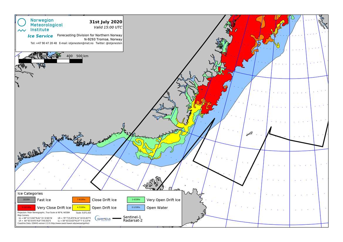
AUG 1 – 4.42 UTC. As she approaches Greenland, NANUQ is about to cross an area of open water with occasional floating ice and areas of “very open drift ice” and “open drift ice”. Ice density is reported acceptable for navigation where the boat is heading for, but situation may change fast and require quick adjustments by the crew. Ice conditions are published and updated daily by the Norwegian Meteorological Institute (NMI) at: <https://cryo.met.no/sites/cryo.met.no/files/latest/denmark_strait_latest.png> . Thanks to her rugged and widely redundant design, NANUQ can safely sail and manoeuvre at low speed in “very open drift ice” (marked in green on the NMI map) and “open drift ice” (yellow). Thicker conditions or even a complete block in ice would not pose an immediate threat to the boat – that was designed for, and has successfully stood, months of complete blocking during her initial trial voyages-, but that would hamper the planned development of the expedition. Therefore, areas of “close drift ice” (orange) and “very close drift ice” (red) will be avoided. Based on the latest ice bulletin (below), it is possible to observe that in the last 24 hours, NANUQ has cruised on a westerly course, apparently with the intention of keeping closer to the open water areas (blue), before approaching the southern margin of the Blosseville Coast. Now very far from usual data connection lines, the crew can only communicate via Iridium (satellite) channel, and messages will be relayed as they are received.

